YOTREPS POSITION Google Earth |
This page is only updated when we're near the internet, check SAILMAIL ENTRIES & YOTREPS POSITION for instant updates!
S&G
DEPARTURE Engine Hours: @182.2 Distance:159 nm WX:Rain / ^11-16°C |
May 29, 2010 Lund BC - Port Angeles
As this is probably
the last chance for internet before we part into the Pacific, I will post
now from PA (Port Angeles) |
|
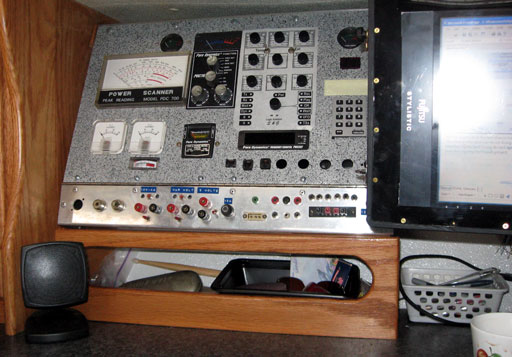
Now we have a
supply for testing things and using the Wishboard if we decide to make a
circuit for something.
The boat was put back into the water a couple of
weeks ago and the rain began about the same time. We motored down from
Lund to Van Anda and bid all our new friends farewell, then waited for
weather. Things were taken to the house, and still other things,
forgotten, were brought from the house. By weight, I think it was an even
trade. |
|
Early the next morning we set off anyway, and
motored to Nanaimo. We only managed to sail for 1 hour before the wind
died. After a night at Nanaimo, we cut through Dodd Narrows, less
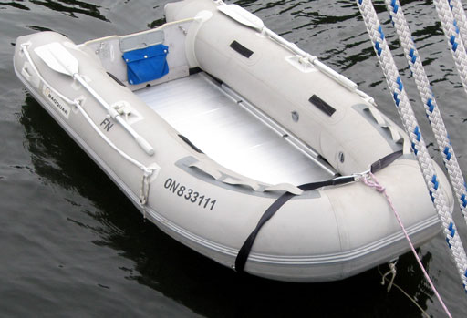
intimidating this time, then straight down to Montague Harbour. We stayed there for a couple of days as the winds were blowing strong from the south east. We didn't mind, it's certainly quieter than Nanaimo! I took the dinghy ashore and adorned her with our registration numbers. Seems the U.S. likes that sort of thing so we thought it'd be a good idea. |
|
Next chance I get,
the words "Fresh Nelly" are going to be painted down the other side! I
think that's a great name for a dinghy. They look like stick-on letters
because I used the leftovers from the stick on letters I used to etch the
brass plate inside the boat last year for templates. Gena had replaced the floor board near her bow as the other one had de-laminated already. It's covered with roof paint speckled with bits of rubber that we found at the cabin. We noticed the support board at the bottom aft is also de-laminating. Guess that'll be fixed in the future...somehow. |
|
After
Montague, we checked into the U.S. at Roche Harbour on San Juan Island,
stayed an extra day again because of strong south winds up the Haro
Strait, then made the run for Port Angeles. There's not really any photos
because it's been misty and miserable mostly ever since we left Van Anda.
Not much to see really. Here at P.A. there's a great view from the top of
the hill, but, as luck would have it, no camera! That aside, the people
here are very friendly, and the town is quaint - no mega-stores! The next entry will be from (hopefully) the Marquesas! Here we go! Sandy, S/V Dulcie-Darlene
|
PASSAGE ATTEMPT Departing Neah Bay for the South Pacific |
June 5th, 2010 Neah Bay -
Brown Bear Seamount area (250 miles) engine=291.1 hrs
distance=576 miles After leaving Port Angeles, 50 miles later, we arrived at Neah Bay, an Indian reserve and fishing village situated next to Cape Flattery on the extreme northwestern tip of the United States. While waiting for weather we thought it'd be nice to have some fresh bread and milk.
|
|||||||
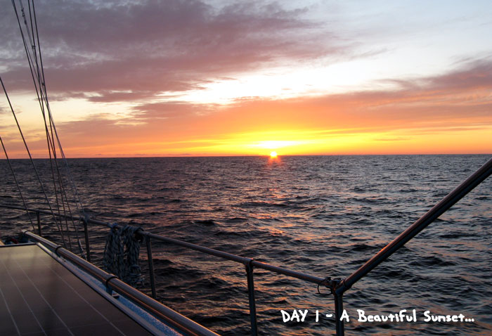
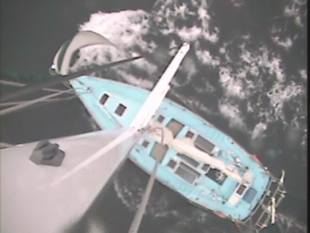
That night, absolutely moonless as we had forgone waiting for a full moon in lieu of fair weather, the water was almost perfectly calm, with just enough wind to push us along. It was getting chilly so I went inside and sat in the pilot house. I could see our wake through a thin layer of fog and phosphorescence. It looked and felt like we were gliding through thin air, a very cool sight indeed! There were pointy winged birds flying around us making a giggling sound, almost dolphin-like, as if they were mocking us which left me feeling intrigued and a little spooked as well. | |||||||
|
|||||||
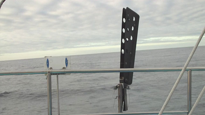
WE still comment on Helmit the auto-helm.
What a great crewman he is! Steering by hand became tiring and boring on
the first day, so I insisted on setting him up.
As long as there's wind, there's Helmit. Even under power in 5 knots of wind...unimaginably light airs...he kept us on course. With all the anxiety and the swells and feeling less the 100%, I felt we would be ok now...that is until I saw the weather fax late on June 6th. |
|||||||
A rather strong low had suddenly popped up
along the continuing front yesterday, but was predicted to head east
towards Oregon. The new position showed it was heading straight for us! Anxiety started setting in, and it's a slow build believe me, and I started getting worried. Worry doesn't do much out here, just keeps you awake instead of resting up for the next watch that you *need* to be awake for! |
|||||||
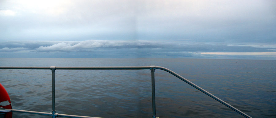
Coming up to day 3, the skies grew ominous toward the west, (photo below) and I kept thinking the low is passing south so nothing to worry about. That was until I saw the newest weather fax, which indicated the low had shifted further north than anticipated. The seas had started to get lumpy even though there was still very little wind. I knew the seas would get pretty big behind the low, but with it's new heading those seas will certainly catch us. | |||||||
We were just coming up on a whole area of
shallow seamounts as Gena had pointed out. These would make the seas even
higher. So we made the decision to head north to avoid the worst of it, and to get away from the seamounts in the event we'd have to heave-to. The motor was started as there was just no wind at all, and was kept running for most of the day. On the next wefax, that evening, it was obvious that the low had shifted even further north, and with our inexperience as to wave heights (16 feet was forecast) and spacing (about 7 seconds) we decided to make a run for it back toward Washington. We knew we couldn't out-run it completely, but maybe we could avoid the worst of it. The bad part of this choice is the notorious shallows before rounding cape Flattery. Expanding out 60 miles is that continental shelf which will cause the swells to pile up much higher. |
|
||||||
Perhaps fatigue played a minor role as well, we hadn't been getting enough sleep with adapting to the motion and just the pure excitement of it all! Heaving-to might have been a good decision to continue with the passage, but the events that followed indicated that we in fact did make the right decision. |
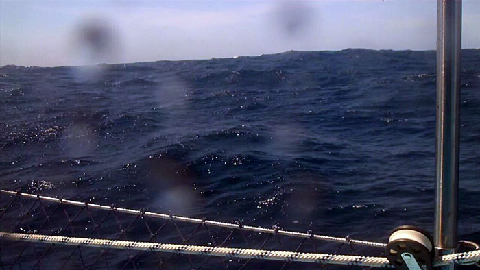
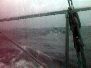
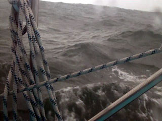
Sea Conditions: As we headed toward the shallows with the gale brushing up behind, the sea conditions grew and grew. On day 4 we think the waves were around 8-10 feet, still fairly spaced apart. We had some sail out to perhaps stop the boat from rocking so much, but the wind was only 10 knots at best. |
||
Enough wind for
Helmit though as he kept us on course. Every once in a while I had to go
out and adjust him some, which became an increasingly dangerous job, with
all the tossing back and forth and occasional breaking seas. We found the Mustang survival suits are very slippery on deck so I plan to sew some pads on the butts and knees! Every once in a while the boat would heal over beyond 45º on a huge wave. We got used to it after a while, but then we dug into a wave and I heard water splashing down below. |
||
As I
went down and forward I saw a jet of water shooting from over my desk at
an angle down to the floor on the opposite side of the cabin! It was like
someone had opened a fire hydrant!
|
||
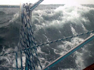
The waves were
getting steeper and starting to break -perhaps 15 feet, and by day 5, I started wondering
if we were in a distress situation or not. The hammering of the
waves on the hull is amazingly loud, and the sudden jerky motion of the
boat would have been inconceivable a year ago. How can such a large, heavy
boat be tossed around so quickly. There were times up front in the berth
that I felt 0 G's as we ran down a wave! The lee-cloth stopped me from
falling out, but it was impossible to get any more than a few seconds of
sleep. I was having a dream that it was my hour on watch, and our dog Poutine, who passed on last year, was trying to climb up onto the pilot seat. |
||
So I picked him up and could feel him walking up my chest when suddenly he was climbing up the side window. Then I awoke hanging in the lee cloth with my feet dangling in mid-air, like as if in a hammock! 2 seconds later I was back on the berth. I immediately ran aft and Gena says, "we were just knocked down you know." in this calm voice. I went, "cool." even though I was feeling pretty upset, I didn't want to show it. She had seen the pilothouse side window under water, and not a leak anywhere! | ||
That wave
that hit us abeam Gena figured to be in excess of 20 feet, as she couldn't
see the top of it out the port side pilothouse window. Once within a few miles of Tatoosh Island, off Cape Flattery, on Day 5, the waves calmed down but ships continued to be a concern. The A.I.S. display on my PC showed where the ships were and their heading. An indispensable tool believe me! Radar is very hard to monitor in those conditions, and doesn't tell you the ships name so you can call them on VHF to ask if they see you on their radar. |
||
With the steeps waves and all the bouncing around we'd experienced, the biggest worry for Gena was those ships. Mine was loosing engine power. We had to shut down the engine after 20 hours to put some oil in. It was down 2 litres! It took a few tries to get the starter to engage to get it started again, so after that we left it running for 48 hours. Gena managed to pour in a litre or so every 10 hours while running, which in those seas is a real accomplishment believe me!! |
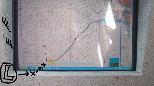
Our track into the Pacific is shown above. 578 miles
and a real learning experience. As the hurricane season down south is
inevitable, we have blown any chance of continuing for the Marquesas this
year. (Addendum: Within 12 days, hurricane Celia and T.S. Darby
now at 15ºN would have caught us for sure had we kept going!) So we'll be
heading back and doing some cruising around US/BC waters. We're a little
taken aback from this experience, and have even more respect for mother
nature, as well as more confidence in our fabulous boat. It's just a
question of confidence in ourselves.
The weather fax only warned us of impending doom, created anxiety, and ultimately made us turn back because of our lack of knowledge about "how big are 15 foot seas?" It may have been good karma though (read on) |
||
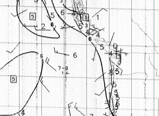
Here's how the charts looked on
the 5th of June, as a 48 hour forecast, received later in the day. The wave heights (in meters) still don't look too threatening and the 96 hour predicts a heading almost straight east. |
||
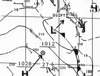
By
early day 3 the low's course was further north than the red marks I added,
and also had became a gale, pushing/absorbing the high pressure right out of
the picture. We were heading north by this time. The wind waves picture is from Day 2, before the low had them all stirred up! |
||
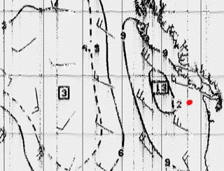
By
day 5, the gale had begun to dissipate, but the mess of waves behind it was
quickly approaching aft. The red dot shows our position. The next wefax
(from Genas paper machine) showed 2 areas of 16 foot waves, no escape! Had we stayed off the shallows, it probably wouldn't have been so bad. But we didn't know how big 6-9 foot swells are, or 15 feet with 4-6 foot wind waves on top. Now we do. |
After thoughts: The word "Karma" has really come into play several times over the past few days we've been back. It means that perhaps this passage wasn't meant to be, and there were many signs to state the now obvious.
More signs of our Dream's impending doom
showed up later. I feel we were dealt a tough blow on our first blue water experience, but we made the right decision because of it, so we're glad it turned out the way it did. We could've been 2000 miles out when all this happened instead of 250. That certainly wouldn't have been good! Even after we returned to Roche Harbor at the
US San Juan Island, we had learned even more lessons thanks to mother
nature. |
PROPERLY PREPARING |
This summer (2011) we will
be getting some sailing experience around the BC coast, working out some
bugs with the sail plan, and enjoying life. Back in the fall we decided to
skip going offshore this year, which, thus far has been pretty miserable
weather wise. With all the flooding inland, lots of rain, and cooler
temperatures, the winter was less than ideal. Sometimes I wish we
could forgo the passage south and just be there!
In any event, the dream lives on and by this time next year, this page will be updating regularly! |
contact us freshnelly.com cdbaby.com Bruce Roberts Yacht Design our forum